What if you could wake up in Monterey and leave your car parked most days? If you love the idea of ocean views, fresh air, and simple routines, car-light living here is real and rewarding. You can run errands, meet friends, and reach work or school using trails, transit, and a smart plan. This guide shows you how to make it work day to day. Let’s dive in.
Why car-light works in Monterey
Monterey’s compact core puts downtown, Cannery Row, the wharf, and neighborhood shops within a few miles. That layout makes walking and short bike trips practical. Local commute profiles also show shorter mean travel times, roughly 16 to 19 minutes depending on year, compared with many California cities, which supports close-to-home routines (Census Reporter profile). Walkability varies by neighborhood, and areas like Old Monterey and New Monterey score high for everyday errands (Walk Score overview).
Trails that connect daily life
Monterey Bay Coastal Recreation Trail
The paved, multi-use Monterey Bay Coastal Recreation Trail runs about 18 miles and links Castroville, Marina, Seaside, Sand City, Monterey, and Pacific Grove. It connects major stops like Cannery Row, Fisherman’s Wharf, Lovers Point, and the Aquarium, so you can bike or walk to cafes, shops, and parks without mixing with heavy traffic (trail overview). Follow posted signs, slow near busy segments, and yield to pedestrians on shared sections.
FORTAG regional link
The Fort Ord Regional Trail & Greenway (FORTAG) is a planned 28-mile paved network that will connect Marina, Seaside, Del Rey Oaks, and Monterey, with links to the coastal trail. As segments open, it will add safe, low-stress routes to schools, CSU Monterey Bay, and job centers, expanding what is feasible without a car (project details).
Transit options for daily trips
MST buses for local and regional trips
Monterey-Salinas Transit (MST) runs local routes in Monterey and regional lines to Salinas, Marina, and beyond. Many residents use MST for commuting and errands when they live close to a stop. Before you go, check maps, timetables, and real-time tools on MST’s site so you can time transfers with confidence (MST system maps and tools).
Free summer trolley
The free Monterey Trolley typically runs seasonally, serving Downtown Monterey, Cannery Row, the Wharf, and the Aquarium. It is a great way to skip summer parking stress for errands and dining. Dates can shift by year, so confirm current details before you plan (trolley announcement).
Park once strategy
If you are driving in from another neighborhood, park in a city garage downtown or near Cannery Row. Then finish your day on foot, by bike, or by trolley to avoid re-parking. Review garage locations and rules before you go so you can choose the best option for your plans (parking and access info).
Errands within reach
Groceries and essentials
For full-service groceries, Whole Foods at Del Monte Center and Trader Joe’s on Munras Ave are convenient to many Monterey neighborhoods. Smaller markets and specialty shops in Old Monterey and New Monterey fill in midweek needs and quick stops (Whole Foods store page, Old Monterey food stores directory). Many residents combine quick walks for smaller items with a weekly bike trip or a delivery for bulk goods.
Pharmacies, banks, and post office
You will find a cluster of services along Alvarado, Del Monte, and nearby downtown streets. For many addresses in Old Monterey and New Monterey, these are a short walk or a quick bus ride away. Check hours before you go, especially on weekends.
Practical car-light strategies
- Map your weekly loop. List your top five stops, then note the closest MST stops and trail connections. A little planning saves time.
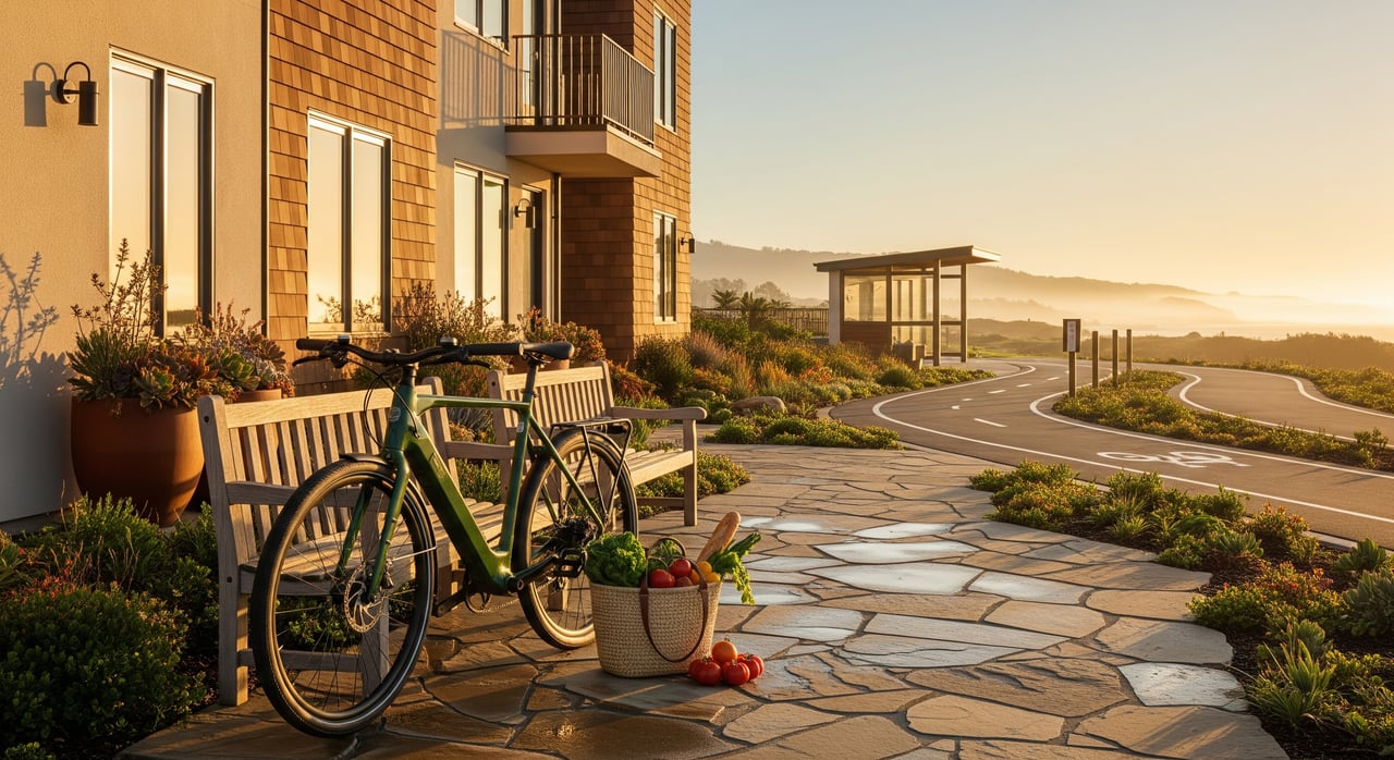
- Gear up for groceries. A backpack, panniers, or a small cargo setup makes weekly shopping easier. E-bikes can flatten hills and extend practical range.
- Use the coastal trail for waterfront trips. It links Cannery Row, the wharf, and Lovers Point with minimal street riding (coastal trail overview).
- Time your rides with MST’s real-time tools. Check arrivals before you leave so transfers feel smooth (MST system maps and tools).
- In summer, plan a park-once day. Park in a garage, then use the free trolley for errands and dining along the waterfront (trolley announcement).
What’s coming next
County and city partners continue to invest in safer biking and walking. TAMC’s Active Transportation Plan and county bike map guide near-term improvements and wayfinding, while FORTAG will add new off-street links across the peninsula. As segments open, expect more low-stress routes for commuting, school trips, and errands (TAMC bike map, FORTAG project).
Neighborhood checklist
Use this quick checklist when you scout homes or plan a move:
- Nearest full-service grocery and hours (Whole Foods at Del Monte Center or Trader Joe’s on Munras)
- Closest neighborhood market for quick staples
- Closest pharmacy and bank
- Nearest post office access
- Nearest hardware or household goods store
- MST stop within a short walk, plus the route numbers you will use most
- Fastest trail connection for everyday trips
- Garage or secure bike storage options at home
A sample car-light day
- Morning coffee and post office: Walk downtown for coffee, then drop mail along Alvarado.
- Grocery run: Ride the coastal trail toward Cannery Row for midweek staples at a neighborhood market.
- Afternoon appointment: Catch an MST bus for a quick cross-town trip. Check real-time arrivals before you leave.
- Evening on the waterfront: In summer, hop the free trolley to dinner, then stroll the trail home.
Choosing a Monterey home with the right trail access and errand hubs can make car-light living a joy. If you are exploring neighborhoods or ready to list, our local team can help you match lifestyle with location. Reach out to the trusted advisors at Carmel Valley Realty Company to start a plan that fits how you want to live.
FAQs
Can you live in Monterey without a car?
- In downtown, New Monterey, and nearby Lighthouse District areas, many daily needs are within walking distance, and MST plus regional trails help cover longer trips; feasibility depends on your exact address and routine.
Is biking practical for everyday errands in Monterey?
- The coastal trail and other off-street segments offer low-stress riding, on-street conditions vary, and upcoming FORTAG links will expand options; an e-bike can make hills and distance easier.
How do you reach Salinas or CSUMB without driving?
- Use MST regional lines that connect Monterey with Salinas and stops near CSU Monterey Bay, and plan transfers with MST’s maps and timetables (example route details).
When does the free Monterey Trolley operate?
- It typically runs seasonally around late spring through summer, serving downtown and the waterfront; check MST for current-year dates and hours before you go (service update).
Where should you park if you want to go car-light for the day?
- Park once in a downtown or Cannery Row city garage, then rely on walking, the coastal trail, or the trolley for the rest of your stops; confirm garage locations and rules in advance (parking info).